Picture of the Day: Snowy Chiricahua National Monument

I was a little shocked to see this much snow just 70 miles north of the Mexican border in Chiricahua National Monument. I pictured southern Arizona a little differently. Hiking in the 8″-10″ of snow under a cloudless blue sky was magical though and I wouldn’t have had it any other way. I hope you enjoy the pictures. rk

Sunday Hikes: Grove of the Patriarchs

This fun trail is packed with lots of cool sights and is quick to complete as it is flat and only one mile round trip. After several days backpacking in the North Cascades this was right up my alley.

Conveniently located right off the main road in Mt Rainier just east of Paradise Visitor Center, this is a must do hike in Mt Rainier National Park.

The trail begins running along the Ohanapecosh River with plenty of large trees and scenic river views.

At the halfway point you cut right and cross the river on a very cool bridge.

This leads you into the Grove of the Patriarchs. This grove of ancient 1000 year old trees is made up of Douglas Firs and Western Red Cedars. The trails through the grove are mostly on wooden boardwalks to protect the trees.

With fellow Bighorn blogger Josh for scale, you can see the size of these amazing trees.

You head back the way you came, crossing the bridge and soon back to the trailhead. Definitely hit this quick hike on your next visit to Mt Rainier.

Thanks for reading. rk

Sunday Hikes: Ernst Tinaja

Big Bend National Park is a wonderful place! Collectively I have spent over a month exploring the park’s near 1,300 square miles (that’s 10x the size of Atlanta). Each new visit brings new places I had never even heard of to explore. One could spend a lifetime in the Big Bend country and still have more to explore. On our last trip one of these places was Ernst Tinaja.

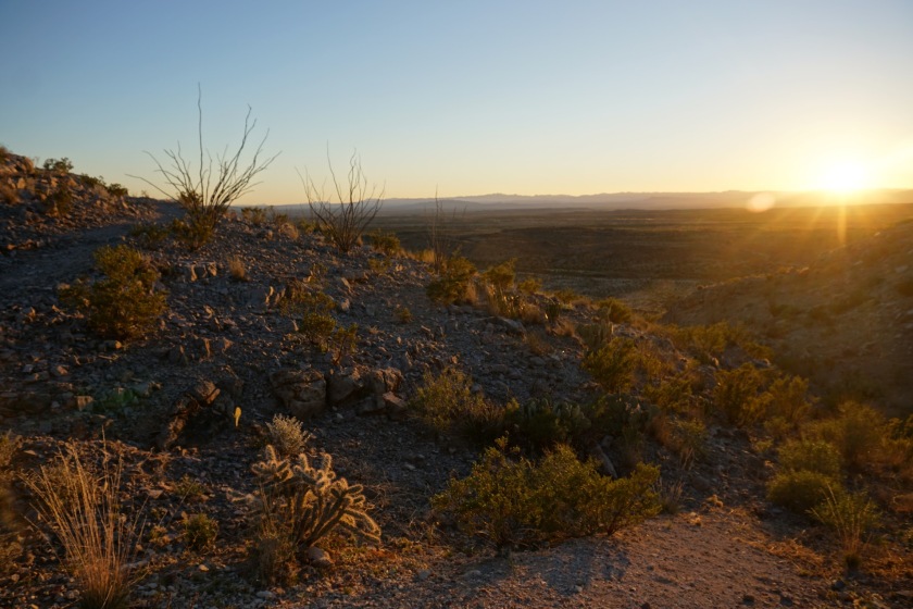
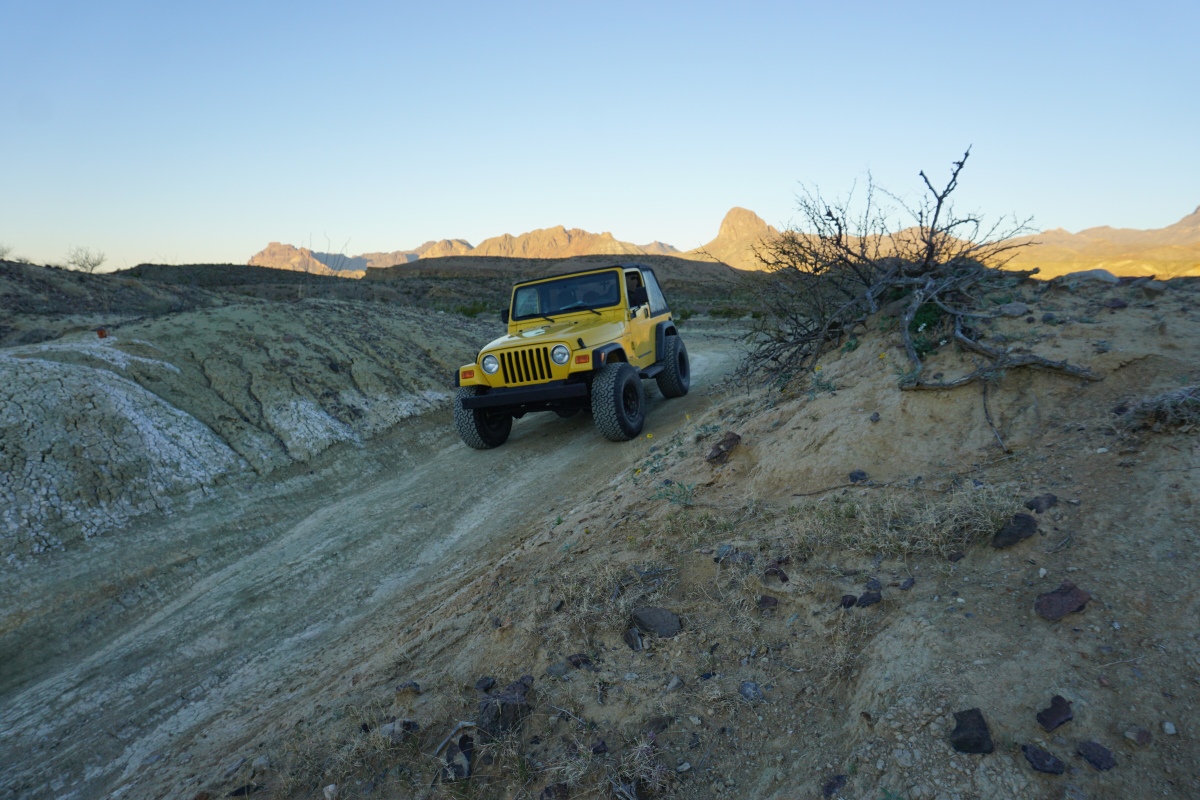
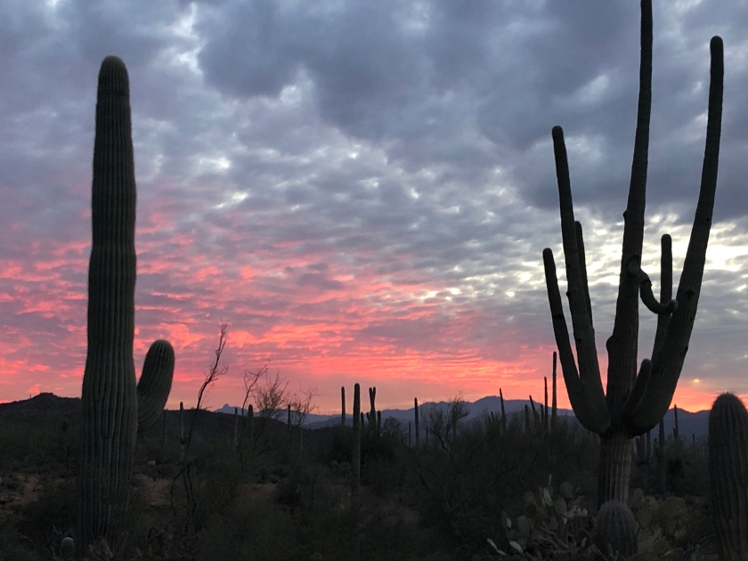
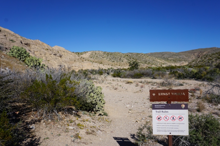
Ernst Tinaja is by no means a secret but it is tucked away in the less visited eastern side of Big Bend National Park. The trailhead is located off the Old Ore Road about 5 miles from the south entrance near Rio Grande Village. Old Ore Road is considered a 4×4 high clearance only road but as long as it is dry most vehicles can make it to Ernst Tinaja driving carefully (if it has been rainy I would not attempt it, visit Panther Junction visitor center for road info). Along the way are beautiful views of the desert and Chisos Mountains.

Chisos from Old Ore Road

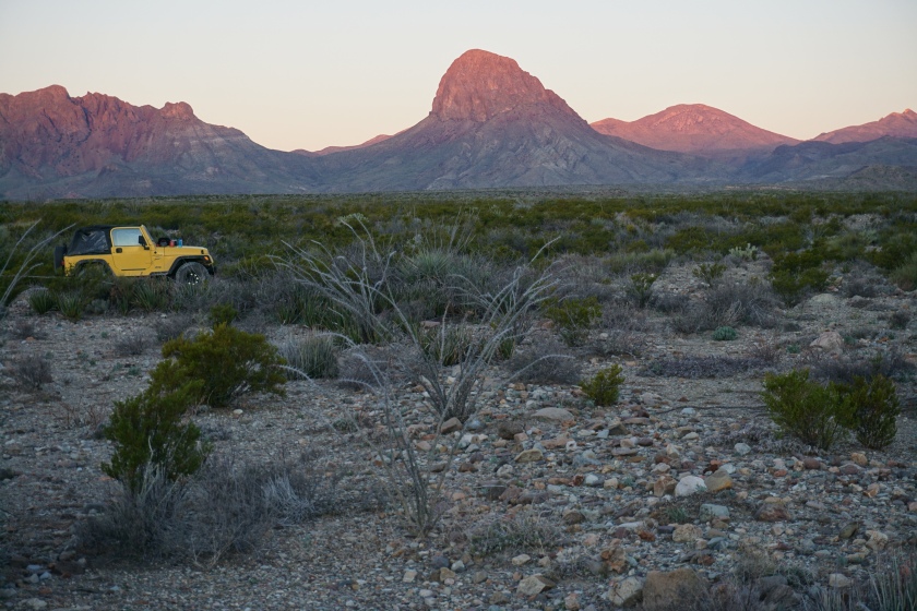
Along the road are a few landmarks starting with Candelilla campsite (one of my favorites), then Camp De Leon campsite and the nearby grave of Juan De Leon (a mysteriously murdered mexican man from the area’s more lawless times). Soon after Camp De Leon is Ernst Tinaja campsite and trailhead marked by a small stone sign. If you hit the La Noria campsites you’ve gone too far.

Grave of Juan de Leon

The trailhead is marked by a small metal sign like most others in Big Bend.

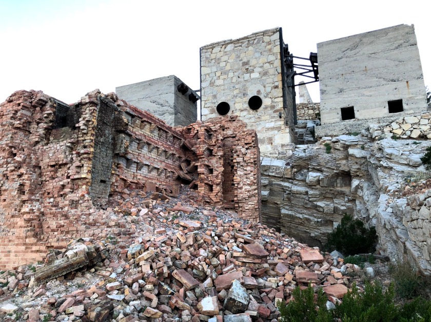
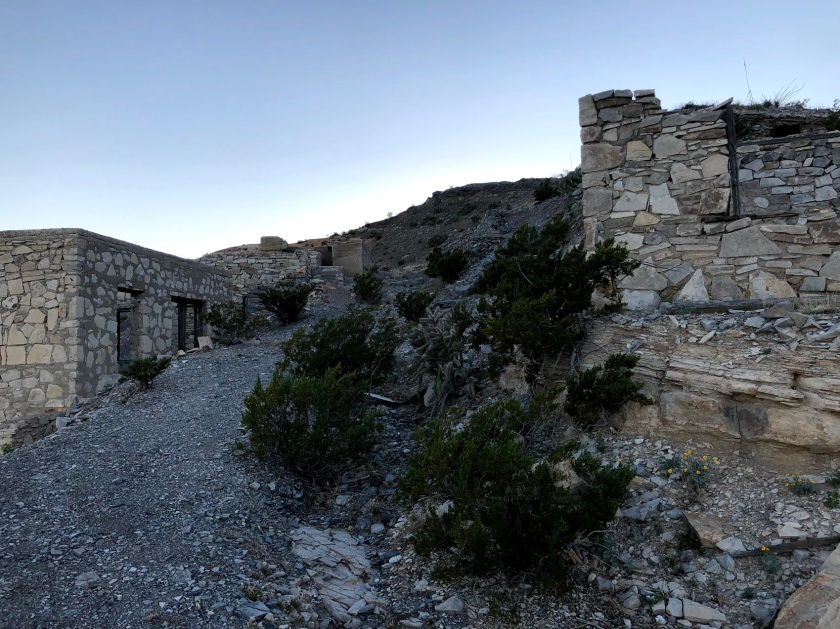
The trail starts in open desert and moves into a valley that then narrows into a canyon. In the valley are large stone ridges running across the trail with small pools of water (after rains anyways). Like many places in Big Bend the past is evident in the geology of the area and it is very clear a river flowed through this area creating the valley and canyon.

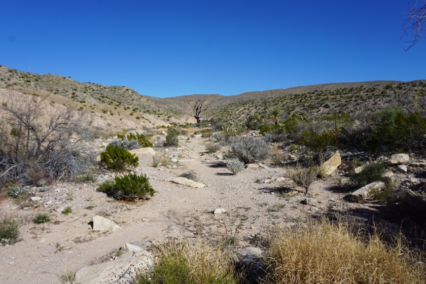
As the valley narrows into a rocky canyon there is a relief of shade created by one of the canyon’s walls during most of the day. When the temperatures can regularly reach the 90s even in the winter, any respite from the sun is welcome. The ground is loose and gravely like most dried up desert creek beds until quickly and suddenly turning to smooth pinkish brown limestone with a slight climb up.

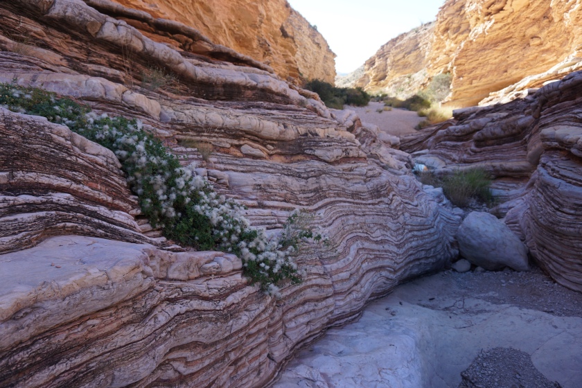
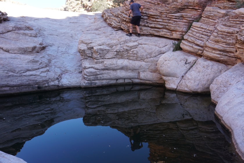
Inside the limestone are three ‘Tinajas’, pockets of water collected from past rains (Tinaja literally means Jar in spanish).

I had fun playing with the tinaja reflections

The climb up and around the tinajas is fun and can feel a little sketchy (especially when you’ve heard accounts of mountain lions drowning in the very tinaja you are scrambling by).

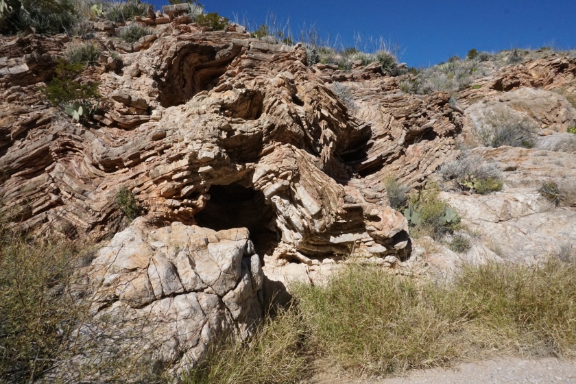
Just past the Tinajas on the left side of the canyon is a fascinating force of nature captured in rock where presumably whatever water once flowed through distorted and twisted the limestone wall into a small cave (another place to hide from the sun).

At this point there are two options: turn back or carry on. The canyon continues for miles eventually hitting Ernst Valley (or at least the hills before Ernst Valley, I have not explored this far). With what seems like endless desert to explore turning back wouldn’t be a bad option either.

PSA: Anyone hiking here should know their limits and pack accordingly to their trip. Over 400 people die in National Parks every year with a majority of these deaths being because of drowning or heat exhaustion (both very possible in Big Bend). Visit the Panther Junction visitor center to get info from rangers on how to explore Big Bend safely.

To sum it all up: Ernst Tinaja is incredible and is a highlight of that trip for us now. If you have the ability to hike there, you should. Be careful and have fun! 🙂

Thanks!

– Josh

Picture of the Day: Sunset in Everglades National Park

Had a wonderful dinner with loved ones as the sun set in Everglades City, FL.

Took a few more pictures from the Everglades National Park Gulf Coast Visitor Center.

Everglades National Park is a great park for kayaking as long as being surrounded by alligators doesn’t frighten you. We saw some really big ones.

As always, thanks for reading! rk

Sunday Hikes: The Chimney Rock Trail

Chimney Rock sounds to me like a hike you would find in Great Smoky Mountains National Park or maybe in the White Mountains of New Hampshire. However, in this case, the Chimney Rock Trail is located in Point Reyes National Seashore in California.

Chimney Rock is a 1.75 mile round trip hike out to a popular whale spotting overlook. The trail gets its name for a small rock island in the ocean visible from the overlook. In addition to whales, the trail promises lots of opportunities to spot elephant seals and sea lions.

The trail starts thru a grassy section heading uphill. I promptly spotted my first wildlife with a rattlesnake crossing the trail about 5 feet in front of me.

Quickly you come to a crest in the trail with a gorgeous view of the coast off to the right. You can see sea lions lounging down below.

Sea Lions are pretty lazy

Continuing to follow the trail up and over the crest soon you are surrounded by ocean on three sides. It is a very beautiful spot to just soak in the views.

Right above the view of Chimney Rock is the best spot to see whales. Remember to bring binoculars! We were lucky as a pod of whales was passing by a few miles offshore. With the naked eye I could see their spray and with binoculars I could see some fins and their backs as they swam by. Pretty cool!

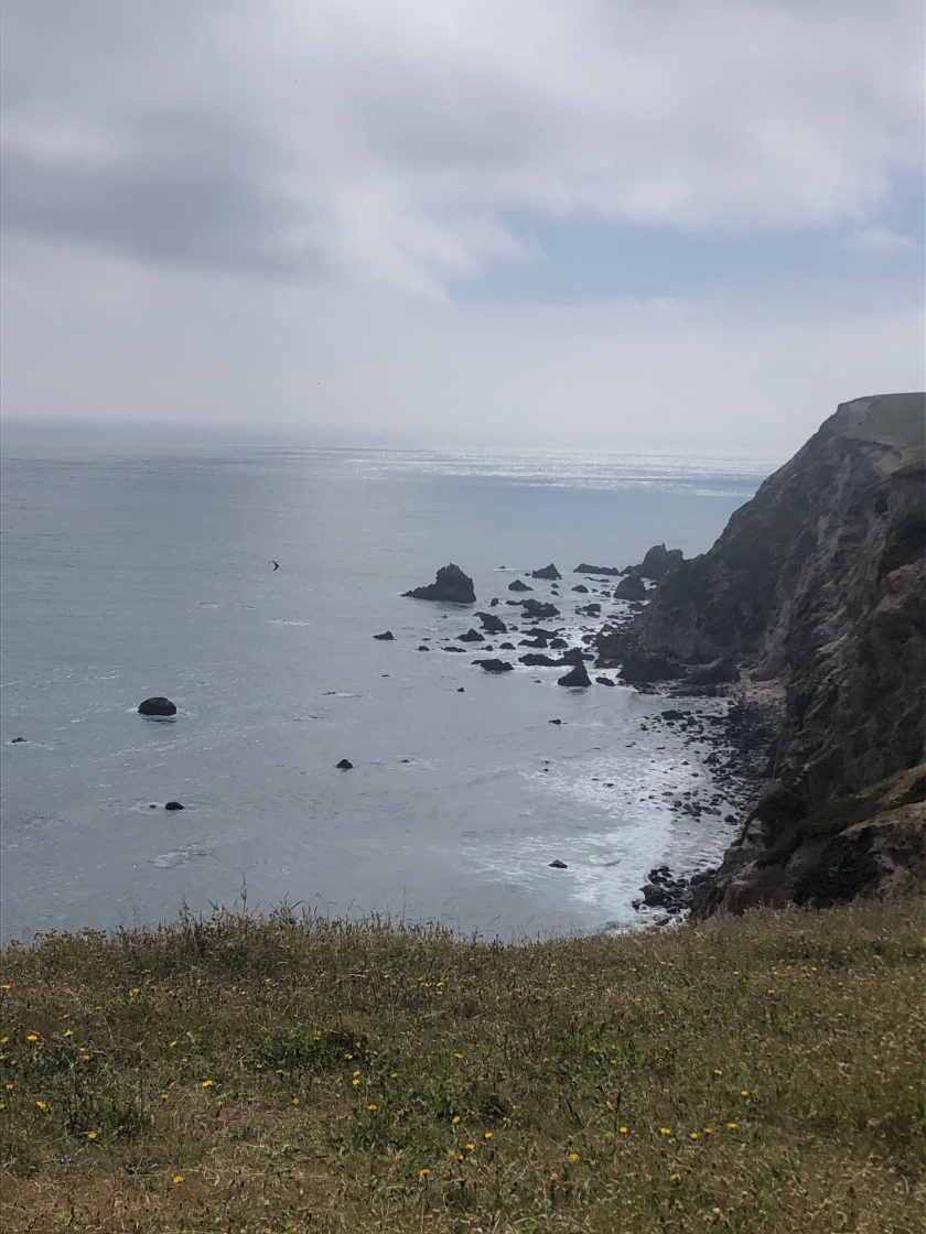
Chimney Rock. My iPhone camera couldn’t pick up the whales sadly.

Looping back, I noticed that there were quite a few elephant seals lazing about on the opposite side of the shore of the peninsula we were on.

Going downhill now, I arrived at the parking lot in short order. There is another shorter trail on the far side of the parking lot with leading to an overlook with a huge population of elephant seals. Some of these were playing in the water so it was good to see some actually moving about.

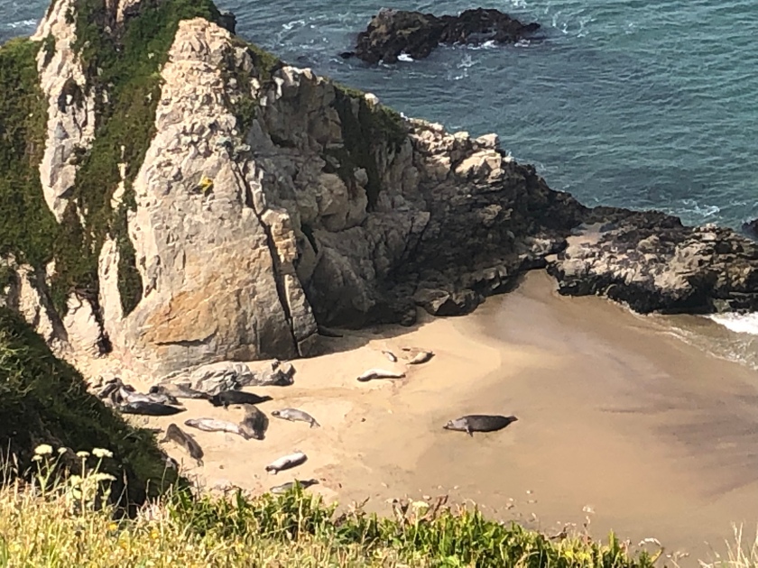
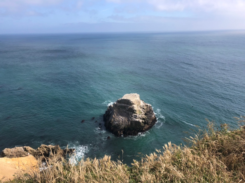
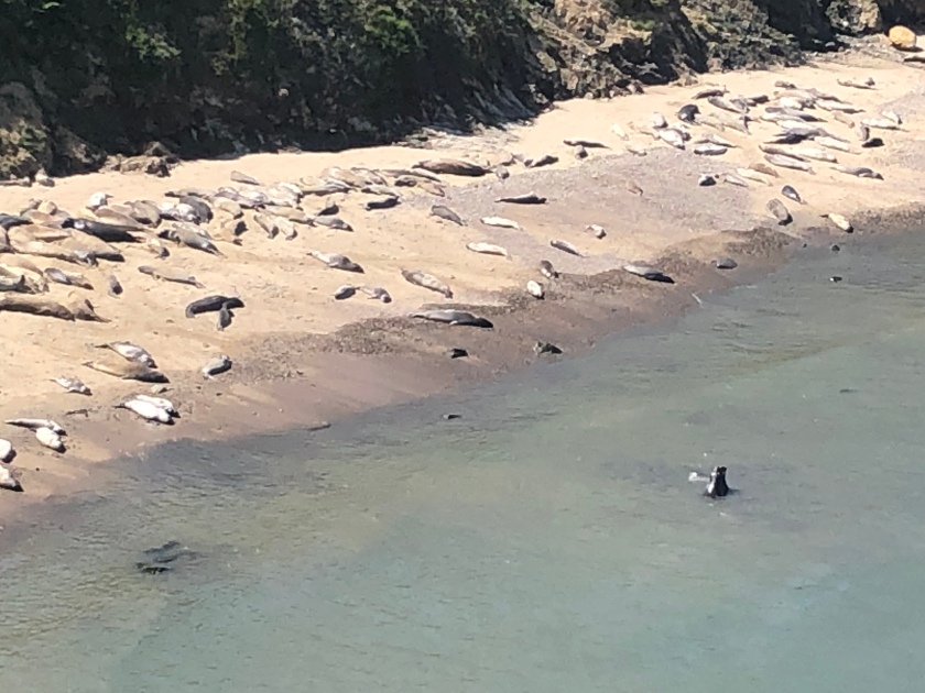
More elephant seals.

Point Reyes and Chimney Rock didn’t disappoint. I recommend checking out this trail and the rest of the National Seashore if you are ever in the area. Thanks for reading. rk

Sunday Hikes: Mariscal Mine

Long before Texas’ Big Bend country was made into a national park it was populated by a handful of small ranches. In 1900 Martin Solis discovered cinnabar near his farm and quickly tried to capitalize on it. Mining continued here sporadically until the creation of Big Bend National Park in 1944. The mine was fairly unprofitable in it’s day but has become a benefit to all future generation as a protected historical site. It is now an eerie reminder of the past in the heart of Big Bend’s backcountry.

IMG_5779.jpg

We visited the derelict mining town after a long day of exploring backroads and canyons on the park’s east side. From the Rio Grande Village area we took the River Road East towards the center of the park. We set up camp at the Fresno backcountry site (the only place you can camp near Mariscal Mine) around 5:30pm and as the sun was setting we rushed to explore the mine.

fresno.JPG

At this point I will say that purchasing the Guide to Big Bend’s Dirt Roads book from any of the camp stores of visitors centers in the park. This book is a well of information for all the parks roads and it has a nice map of the Mariscal Mine complex telling you what each building is and what it was used for.

map_23.jpg

The hike begins in a small dirt parking area with rock houses scattered around where the former miners once lived. There is a sign at the trailhead with a warning not to touch anything because of the mercury that has soaked into the bricks. Up on the hill we could see the mine blending in with its surroundings as it is made of rock from the hill it sits on. The trail up to the mine is loose and rocky dirt so we had to be careful not to slip while trying to take pictures and hike at the same time. The largest structure in front is one of the many furnaces used to melt down the mercury containing cinnabar ore.

org_dsc01188

The trail curves past the large furnace and gains some elevation to get a view of the complex from above and to see the mines themselves. Large deep and dark pits with metal grates blocking entrance. some went like a doorway into the mountainside and some were just a hole in the ground dropping vertically  to the center of the earth (or close to it at least). The only other people out there, some kids and two adults with them were dropping rocks and sticks into the largest mine shaft and counting before it hit the bottom.

IMG_5784.jpg

mine.JPG

We reached the end of the trail at a high point overlooking the mine with great views of Boquillas Canyon and the east side of the park as well as the setting sun and west side of the park. After enjoying the view for a bit we started to head back down, peeking in the mines along the way.

east.JPG

west.JPG

We spent about an hour hiking and exploring the Mariscal Mine area with the trail being about 2 miles out and back. The mine is in the middle of nowhere and takes an hour to drive to but it is well worth the trip!


Thanks! – Josh

Friday Favorites: Black Gap Road in Big Bend National Park

Much of Big Bend National Park is primitive roads requiring high clearance and off road tires. 4 wheel drive is a plus! Since Josh has popped several tires in the Park before, this time he decided to bring me (and my Jeep).

My favorite section was Black Gap Road. This area required 4 wheel drive to navigate and since we backcountry camped nearby, we had the road to ourselves. Black Gap Road traverses a rock canyon and we had a blast.

In the video below, you can hear me worrying about splashing Josh, and Josh worrying that I’m going to leave him behind. In any case, off-roading and exploring the backcountry and ruins was my favorite part of Big Bend National Park. rk

Picture of the Day: Sunset in Saguaro National Park

We’ve shared the sunsets in Saguaro National Park before, but they never seem to disappoint. I caught this one a few days ago off of the Bajada Loop Drive. rk

Picture of the Day: Arch in Bryce Canyon National Park

This is a cool arch I saw when visiting Bryce Canyon NP. It’s probably named, but I don’t know what the name is. Bryce Canyon is such a fantastic National Park. I’d like to get back there to explore the park some more.

Update: I found out in my notes that this arch is called Natural Bridge. It’s located about 4 miles down the main road from the lodge and Sunrise Point. rk

The 5 National Park Hikes on My Bucket List

Yesterday I wrote about my 5 favorite National Park hikes that I have completed. It brought back a lot of great memories. If you missed it, check out these favorite hikes here.

Today I am writing about the Top 5 hikes I want to hike. Without further ado, here we go!

1) The Narrows in Zion National Park. This is a 16 mile hike literally in the Virgin River flowing through a slot canyon with walls as high as 1000 feet. It requires a permit to hike. I was able to get a taste of this a few years ago and have wanted to come back and hike the entire Narrows ever since.

2) Cascade Pass in North Cascades National Park. I’ve wanted to hike in this National Park ever since seeing it out of an airplane window. Cascade Pass is a great day hike with panoramic views of peaks and glaciers.

3) The Teton Crest Loop in Grand Teton National Park. This 30 odd mile hike would include some backcountry camping in the heart of the Grand Tetons. As beautiful as the Grand Tetons are from Jenny Lake, I bet it’s even more gorgeous up in the Tetons. This trail requires a permit.

4) The Peekaboo Trail in Canyonlands National Park. From Grand View Point in the Island in the Sky section of Canyonlands, I was able to gaze into the ruggedly beautiful Needles section and I’ve wanted to go there ever since. Bonus is this 10 mile trail through classic Canyonlands landscape is only accessible by 4 wheel drive!

5) Half Dome in Yosemite National Park. Possible the most iconic and photographed hike in the National Park System. It’s also dangerous and incredibly difficult. I keep telling myself it can’t be scarier than Angels Landing, but I think it may be. 14.2 miles via the Mist Trail and all those famous waterfalls and then up those steel cables to the summit of half dome. This one requires a permit also.

One thing that makes it difficult to get these hikes all done is that most of them are only open in the summer and require a difficult to obtain permit. The limited hiking season (and limited vacation time) means it will take a few more years for me to hike all of these.

I’d love to hear what National Park hikes are your favorites or are at the top of your bucket list. Let me know in the comments. Thanks! rk