Arches National Park is not one of those massive National Parks like Yellowstone where it is impossible to do everything in a weeklong trip. In fact, the majority of Arches NP can be done in a single day if you plan right and pack plenty of water and food. You are going to want to stay in nearby Moab. It is a cool town with everything you need and more.
Tower of Babel and Sheep Rock
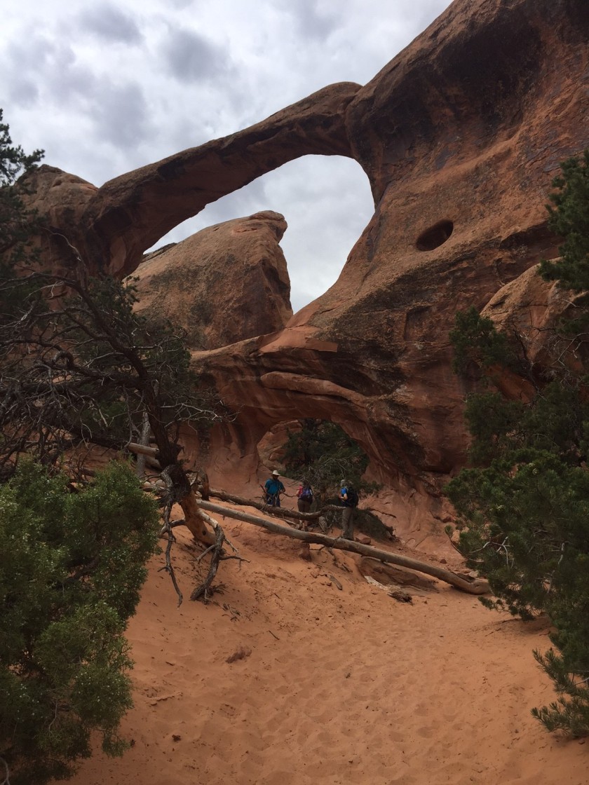
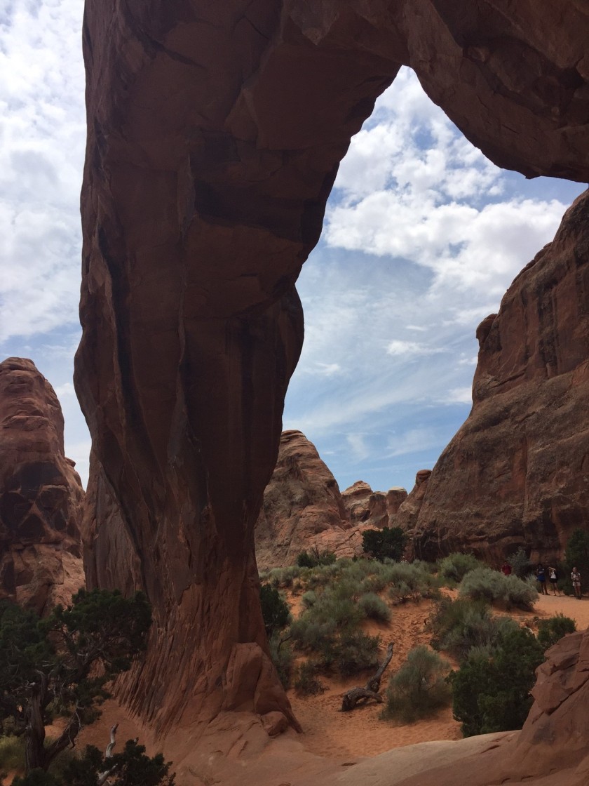
You will need to get up early and beat the lines into the park (which in summer can get lengthy). In fact, when we went thru around 6am the gates were just open with no one in the toll booths checking to see our Park Pass. You should be able to pick up a park map here, otherwise grab one from the boxes outside the Visitors Center. I would recommend driving straight through to the back of the park and park at the Devils Garden Trailhead. This is about an 18 mile drive. Here you can take the 7.2 mile Primitive Trail and see a bunch of arches including famous Landscape Arch, as well as Partition Arch, Navajo Arch, Double O Arch, Private Arch, Pine Tree Arch, Tunnel Arch and Skyline Arch. There are also smaller unnamed arches through this area. This trail is somewhat primitive (hence the name) after passing Landscape. It can sometimes be confusing where the trail is so make sure it is daylight when you start this trail. It will take approximately 3 hours to complete this trail depending on your pace. This is the longest hike of the day, but definitely one of my favorites. You can read more about it here: https://bighorntravelblog.com/2017/01/01/sunday-hikes-the-devils-garden-primitive-trail/

Landscape Arch
Before leaving this section of the park, there is another quick trail called the Broken Arch Loop. It will take you by Sand Dune Arch and Broken Arch. If you drive over and park near the Sand Dune Arch you can have a picnic lunch there and then quickly see the two arches on this trail and then return without doing the entire 2 mile loop.
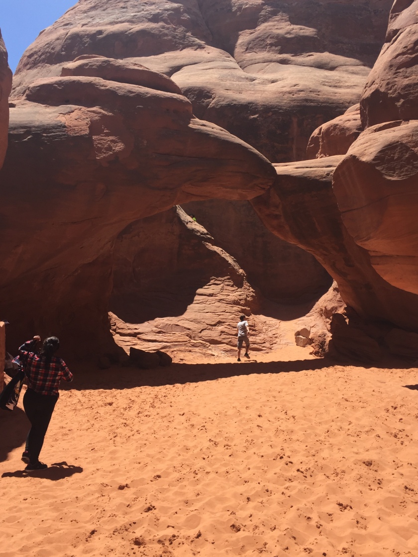
Sand Dune Arch
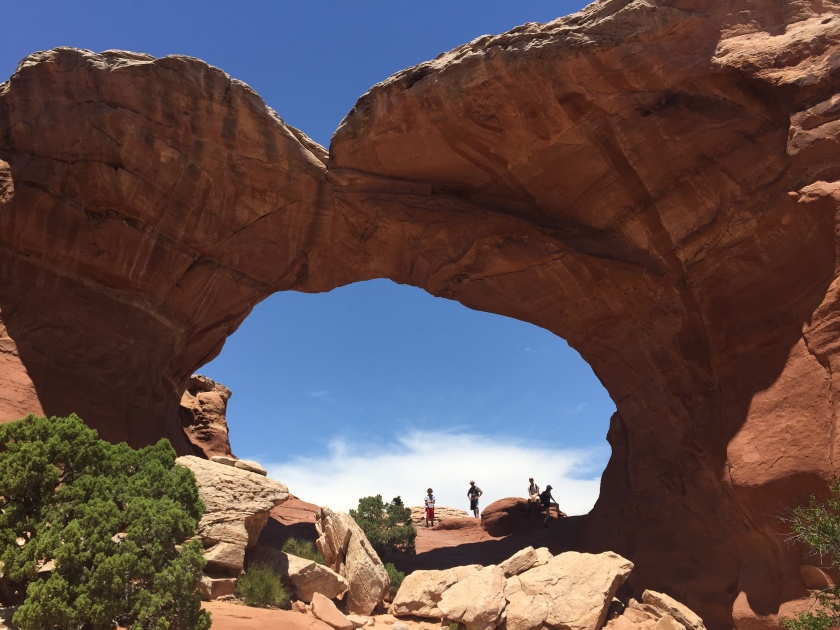
Broken Arch
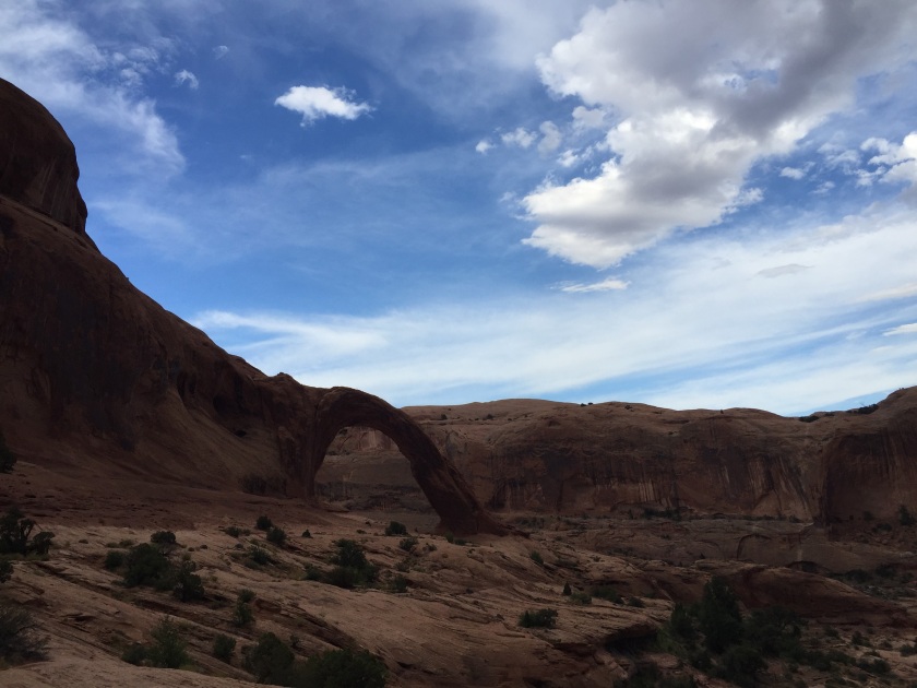
From here drive part way back towards the front of the park. Park and take a quick look at the Fiery Furnace Viewpoint. This area of narrow canyons requires a permit and/or a ranger guide. Check it out and then make plans like I did to come back another time to do this section of the park. It’s a cool overlook so it is worth the quick stop.
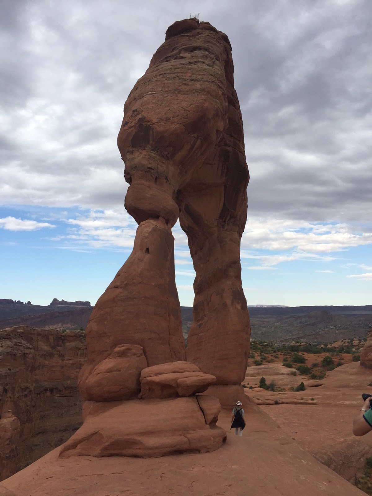
Hop back in the car and take the turnout to Wolfe Ranch and Delicate Arch. The trail to Delicate Arch is 3 miles round trip and is a real fun hike with elevation changes and a ledge with a good drop near the turnaround point. Once you get to Delicate Arch, plan to spend some time in this area to take pictures. There is often a line of folks waiting for their turn to get their picture made with Delicate Arch. Delicate Arch is much bigger than you think and it is astonishing to see how it defies gravity. Don’t skip this trail as this is in my opinion the most spectacular Arch in the park.

Delicate Arch
Once you get back to your car, drive back up to the front of the park and take the turnoff towards the Windows section of the park. By this time, you may be getting tired of hiking so you will be glad to see that all the arches in this section are right by the parking lot. Short loop trails will take you to Cove Arch, Double Arch, Turret Arch, and the famous North and South Window Arches.
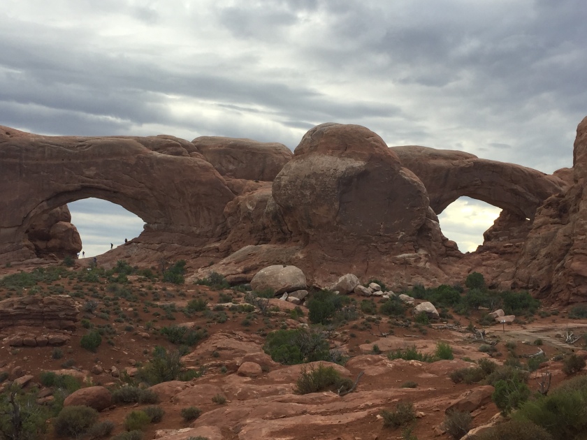
North and South Windows Arches
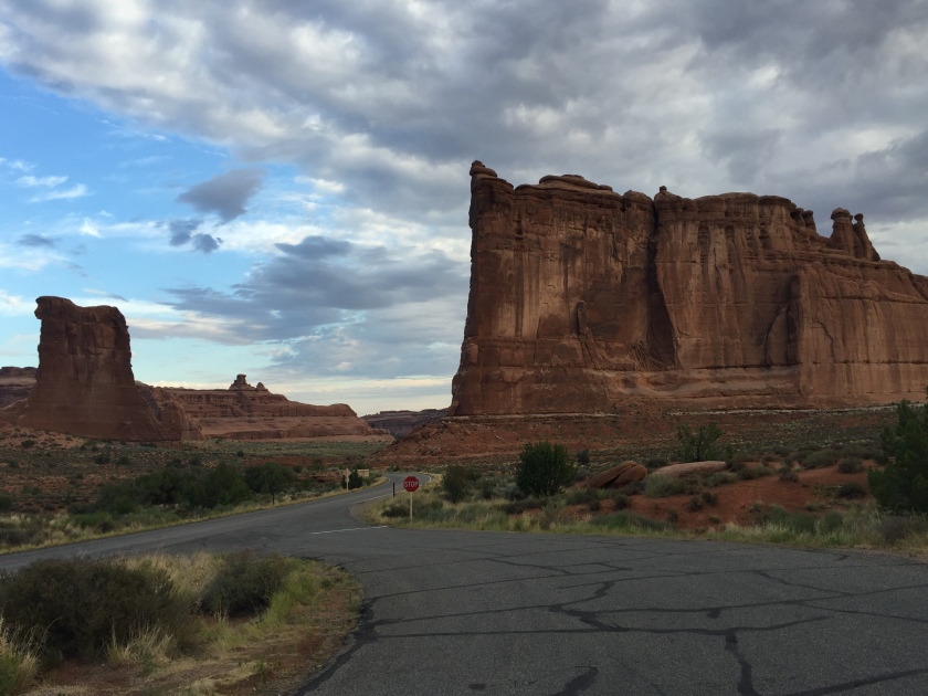
From Windows, head up to the park entrance and park near the Park Avenue Viewpoint. There is a one mile trail where you can see the Courthouse Towers area up close and personal. By this time it is probably getting to be late afternoon. If you have 4 wheel drive, consider spending the rest of the afternoon driving the unpaved road to the Klondike Bluffs area. There are some short hikes in that area to see Tower Arch and others. Just going 4 wheeling is probably enough of a reason to take this loop. If not, head back to town for dinner and to get cleaned up and then head back to the park after dark to see the stars. There is great stargazing throughout the park and if you happen to be there during a new moon prepare yourself to be amazed at the stars in the night sky. I hope this itinerary was helpful and you enjoy Arches as much as I did. rk
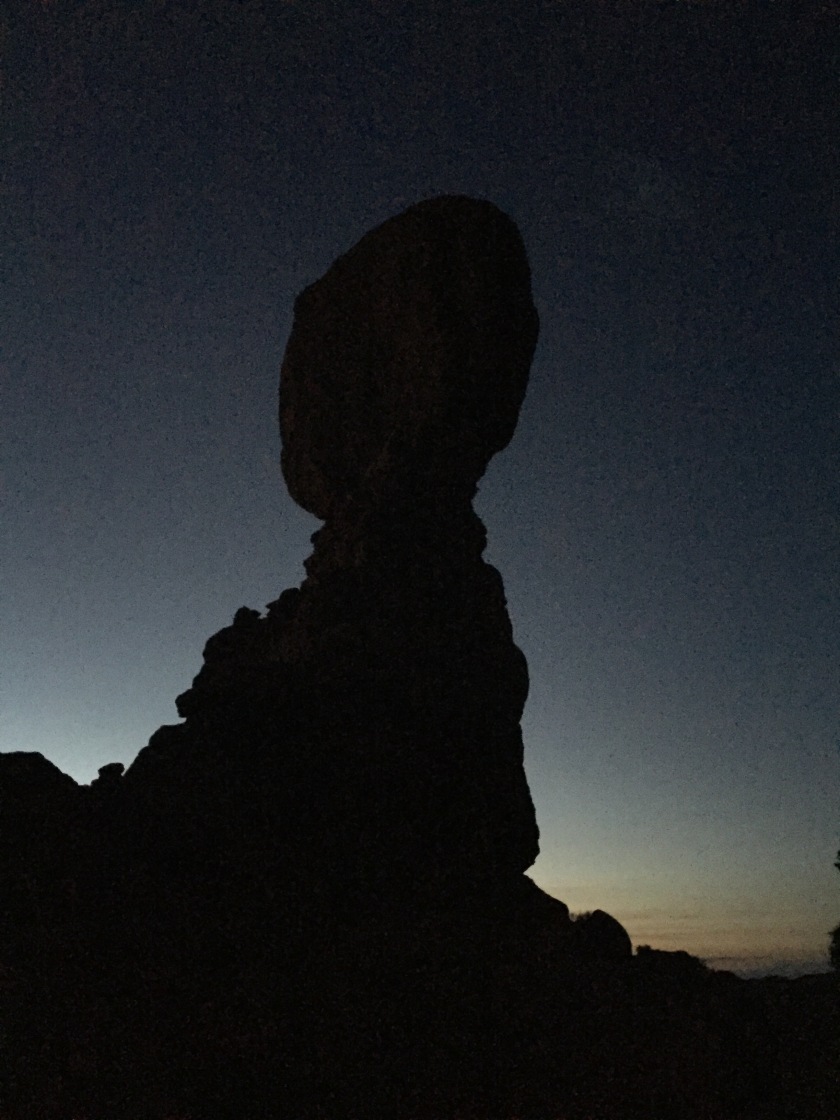
Balanced Rock at Night


 Thanks! – Josh